
The core problem: speed, fidelity, and uncontrolled airspace
Small teams and single operators face a narrow window to capture reliable 3D data over live sites. Weather shifts, moving assets and crowded airspace force trade-offs between resolution and safety. Practical solutions require focused drone reconnaissance that balances survey-grade sensors with operator simplicity. The industry term here is UAV; but the challenge is operational: deliver repeatable mapping without escalating risk to people or property.
Operational constraints and real-world anchor
Events like the 2018 Gatwick airport shutdown show how a few unauthorized small drones can halt major infrastructure. Every mission must account for airspace denial, interference and public safety. Key constraints are payload limits, battery endurance and GNSS reliability. LIDAR or high-resolution photogrammetry improves output but raises weight and power demands. Teams must plan flight corridors, geofencing, and fallback procedures before launch to avoid costly interruptions.
Practical system choices that matter
Choose hardware that matches mission scope. For linear corridor inspection, fixed-wing UAVs offer range and steady imagery. For tight urban scans, multirotor platforms give hover control and denser point clouds. Add RTK for centimeter-level positioning when orthophoto accuracy matters. Keep the sensor suite lean: a calibrated camera plus optional LIDAR often beats a crowded, overpowered payload when speed and turnaround matter.

Operational production teardown: workflow and keywords
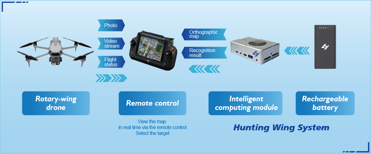
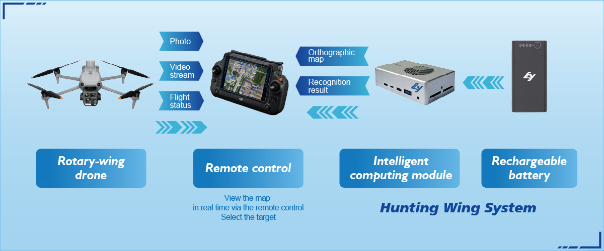
Break a mission into discrete phases: plan, prep, fly, process, validate. During planning, define ground control and flight altitudes. Prep includes battery cycles, sensor checks and uploading geofencing parameters. Fly executes preapproved waypoints while on-board telemetry enforces safe corridors. Process converts raw frames to orthomosaic or point cloud, then runs quality control on ground control points. Validate with cross-checks against baseline maps. This operational production teardown embeds both drone reconnaissance and portable drone detection where sensor fusion or RF monitoring is required for situational awareness.
Common mistakes teams make — and how to avoid them
Teams often overload payloads, underestimate wind impacts, or skip redundant data collection. Skipping a short secondary pass for overlap saves time but costs usable coverage—so budget overlap. Another frequent error: relying solely on GNSS without local control points. A small GCP grid eliminates systemic drift. Also, assume interference: deploy portable drone detection when operating near airports or sensitive sites to flag intrusions early—this is non-negotiable for critical infrastructure work.
Integration points: sensors, software and mitigation
Map software must accept raw telemetry (telemetry, IMU, camera metadata). Automated workflows that ingest RTK corrections and tag imagery speed deliverables. For mitigation, integrate RF detection and ADS-B filtering to separate authorized traffic. Use simple dashboards that present a single severity metric for the operator—keep alerts actionable rather than verbose.
Advisory — three golden rules to select the right approach
1) Accuracy-first threshold: Define the minimum spatial accuracy you need (e.g., 5–10 cm) and select sensor + RTK options that meet that threshold in real operating conditions. Validate with ground control before full execution.
2) Resilience score: Rate platforms by battery redundancy, warm-up time, and fail-safe behaviors. Prefer systems with automatic return-to-home, controlled descent, and remote payload shutoff to limit mission failure modes.
3) Situational awareness integration: Require a portable drone detection layer and RF/visual fusion on any mission near populated infrastructure. This reduces false starts and provides a legal audit trail if incidents occur.
Closing observation
These rules convert uncertainty into predictable outcomes; they’re measurable and repeatable, and they directly shape operational budgets and timelines. For teams that need single-operator efficiency plus robust mapping and detection, the practical value is clear: fewer aborts, faster deliverables, and defensible data. Icecypress Technology aligns with that approach by pairing compact reconnaissance hardware and detection tools into coherent workflows—real systems for real conditions. —